(Le Mars) — State legislators were able to get their first look at the new Congressional and State District maps last week as the new proposed maps were unveiled by the State Legislative Services Agency. Every ten years, after the U-S Census report, state legislative districts are reconfigured to take into consideration of the different population shifts. State House Representative, Republican Dr. Tom Jeneary of Le Mars tells of the time table legislators have to either adopt or reject the proposed configuration of new districts.
Jeneary says the proposed new district map, if approved, would pit several legislators against each other including having Republican State Representative Skylar Wheeler of Orange City and Jeneary located within the same district.

The proposed map would cut Plymouth County in half with county road C-38 being the southern border of the district, and the northern border would include the first two tiers of townships from Sioux County and would include the communities of Orange City, Alton, Granville, Maurice, Hospers, Ireton, Hawarden, Chatsworth, Akron, Westfield, Craig, Brunsville, Le Mars, Seney, Struble, and Oyens. Merrill, Hinton, Remsen, and Kingsley, along with the Plymouth County townships of Meadow, Remsen, Henry, and Garfield would be placed in another legislative district. The town of Sioux Center would also be in a separate legislative district. Jeneary says it is his hope, along with many of his constituents’ that the Legislative Services Agency would leave Plymouth County as one legislative district.
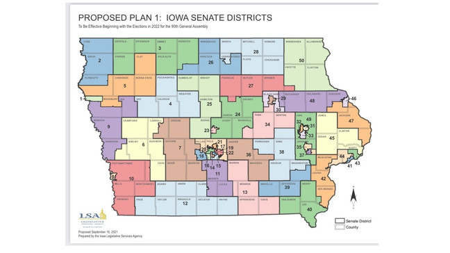
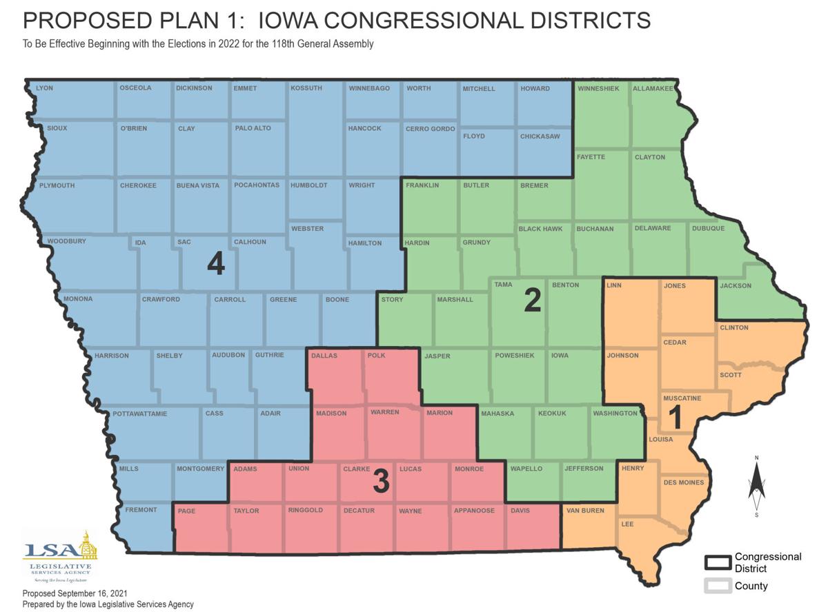
As for the proposed State Senate Districts, Republican Jeff Taylor would expand his district to include much of the northern half of Plymouth County, as well as Sioux County, and Lyon County. Republican State Senator Jim Carlin’s proposed district would go further east picking up the southern half of Plymouth County, but it would also include Cherokee County and Buena Vista County. In terms of the U-S Congressional Districts, the proposed map would show the 4th District, currently being represented by Congressman Randy Feenstra, to go from the current 31 counties to a proposed 44 counties. The proposed congressional district would split the state nearly in half diagonally, and would extend from the Minnesota border on the north to Fremont county which borders the state of Missouri to the south. The proposed new Congressional district would also include Chickasaw, Floyd, Howard, and Mitchell counties to the east.